
Scientists determine the sea level evolution and tsunami record in the North Sea over the last 10,000 years
Pedro Costa, Professor at the Department of Earth Sciences - Faculty of Sciences and Technology of the University of Coimbra, is part of the international team of researchers.
An international research team is studying the evolution of the relative sea level curve and the tsunami record in the North Sea over the last 10,000 years. Pedro Costa, professor at the Department of Earth Sciences (DCT) of the Faculty of Science and Technology of the University of Coimbra (FCTUC), is the UC coordinator of the project NORSEAT- Storegga and beyond – North Sea tsunami deposits offshore Shetland Islands.
The project aims to improve the understanding of tsunami hazard in the North Sea by identifying onshore and offshore tsunami depositional signatures.
“The aim is to compile evidence of events, combine onshore and offshore archives to determine the dynamics of the main events and, finally, to determine the evolution of the Shetland Islands' relative sea level curve. These data are essential for developing more rigorous risk assessments and flood projections," says Pedro Costa.
Tsunamis are relatively rare in the North Sea basin, with the Storegga tsunami being the best-known example. This event was triggered about 8200 years ago by a massive underwater landslide on the Norwegian continental slope. Its impact left significant sedimentary evidence of widespread inundation at various onshore locations throughout the North Atlantic and North Sea regions, including Canada, the Faroe Islands, the Shetland Islands, Iceland, Norway and the UK. In addition, deposits from tsunamis around 5500 years BP and 1500 years BP have been identified in coastal areas of the Shetland Islands.
© DR
© DR
"Recent evidence of past tsunamis suggests a real low recurrence rate of tsunami events in the region. However, due to the nature of the North Sea basin and its coastlines, which are characterised by either limited accommodation space or poor preservation of event deposits due to erosion or anthropogenic reworking, these results are likely to underestimate the tsunami hazard of the entire basin.”, Costa explains.
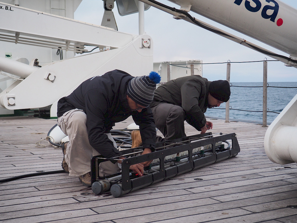
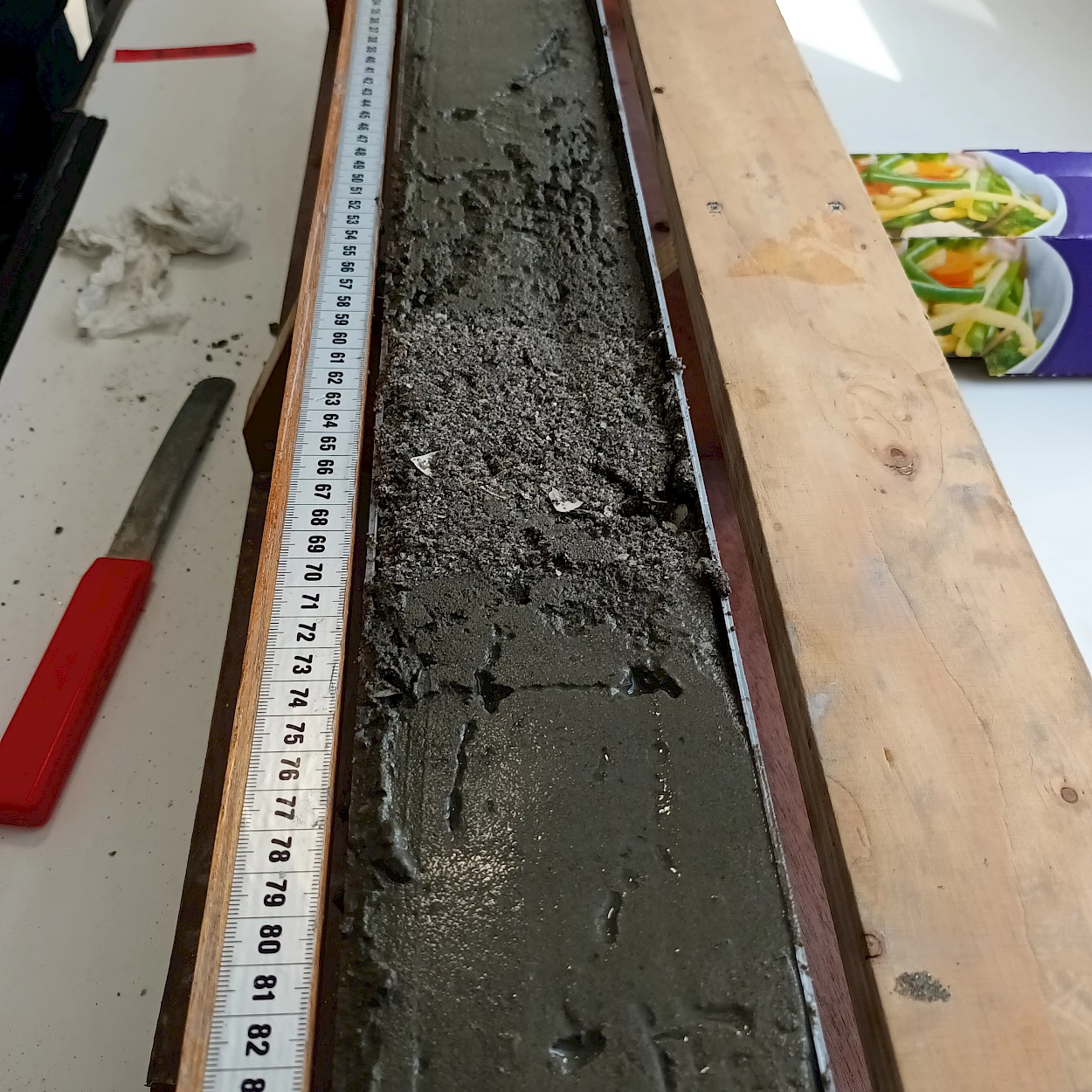
In contrast to onshore tsunami deposits, offshore tsunami deposits have received considerably less attention, although they are much more likely to be preserved in the sedimentary record and to contain pristine tsunami depositional signatures, especially those deposited in sufficiently deep marine environments.
"Such offshore sedimentary tsunami archives are essential to improve our understanding of the tsunami hazard in the North Sea. In addition, knowledge of the relative sea level position at the time the tsunamis hit the coast is crucial for sediment transport and inundation modelling, and for the development of improved risk assessment.".
Researchers are therefore tracking tsunami deposits, studying their extent and characteristics in detail, and investigating whether the offshore record may contain evidence of other events, providing new insights into recurrence intervals. They are also trying to reconstruct the Holocene relative sea level curve, which is poorly constrained for the Shetland Islands, to better estimate the run-up heights of palaeo-tsunamis.